Text size
Line height
Text spacing
This course develops your ability to collect and interpret spatial information for surveying, mapping and land-related decisions. Learning combines technical study with practical tasks relevant to Southern African organisations and communities.
The programme combines supporting studies, specialist subjects and practical integration. Each subject below includes its learning focus, outcomes, practice and assessment.
17 subjects are listed below, with a short description of each. The Subject descriptions tab contains the learning outcomes, topics, practical tasks and assessments.
Develop a supervised survey and mapping project with a field plan, measurement records, quality checks and a final map.
Each subject below includes its purpose, learning outcomes, main topics, practical task and assessment approach.
Specialist subjects
Explore the communication of technical information through drawings and models. Practice centres on a checked drawing or model portfolio, drawing on drawing conventions, scale and dimensions and views, sections and projection. You will record findings, justify decisions and check dimensional consistency, completeness and usability by another person.
For Cadastral Survey, prepare a checked drawing or model portfolio in a land surveying and geomatics setting. Use supplied records, a realistic simulation or authorised supervised practice. Include your working and checks of dimensional consistency, completeness and usability by another person.
Applied questions, a worked case and an individual explanation supported by calculations, diagrams or records. Compare alternatives and justify the selected response using evidence.
Specialist subjects
Explore the use of property information to support responsible ownership and service decisions. Practice centres on a property inspection and management case report, drawing on property types, interests and responsibilities and inspection and property records. You will record findings, justify decisions and check evidence relevance, stated property interests and defensible assumptions.
For Land Administration And Management, prepare a property inspection and management case report in a land surveying and geomatics setting. Use supplied records, a realistic simulation or authorised supervised practice. Include your working and checks of evidence relevance, stated property interests and defensible assumptions.
Applied questions, a worked case and an individual explanation supported by calculations, diagrams or records. Compare alternatives and justify the selected response using evidence.
Specialist subjects
Explore the measurement and representation of positions, levels and land features. Practice centres on a field record, calculation sheet and checked plan, drawing on coordinates, reference systems and control and survey equipment and field preparation. You will record findings, justify decisions and check reference consistency, closure checks and traceability of observations.
For Mine Survey, prepare a field record, calculation sheet and checked plan in a land surveying and geomatics setting. Use supplied records, a realistic simulation or authorised supervised practice. Include your working and checks of reference consistency, closure checks and traceability of observations.
Applied questions, a worked case and an individual explanation supported by calculations, diagrams or records. Compare alternatives and justify the selected response using evidence.
Specialist subjects
Explore the measurement and representation of positions, levels and land features. Practice centres on a field record, calculation sheet and checked plan, drawing on coordinates, reference systems and control and survey equipment and field preparation. You will record findings, justify decisions and check reference consistency, closure checks and traceability of observations.
For Photogrammetry And Remote Sensing, prepare a field record, calculation sheet and checked plan in a land surveying and geomatics setting. Use supplied records, a realistic simulation or authorised supervised practice. Include your working and checks of reference consistency, closure checks and traceability of observations.
Applied questions, a worked case and an individual explanation supported by calculations, diagrams or records. Compare alternatives and justify the selected response using evidence.
Specialist subjects
Explore the measurement and representation of positions, levels and land features. Practice centres on a field record, calculation sheet and checked plan, drawing on coordinates, reference systems and control and survey equipment and field preparation. You will record findings, justify decisions and check reference consistency, closure checks and traceability of observations.
For Global Navigation Satellite System (G.N.S.S.) Survey, prepare a field record, calculation sheet and checked plan in a land surveying and geomatics setting. Use supplied records, a realistic simulation or authorised supervised practice. Include your working and checks of reference consistency, closure checks and traceability of observations.
Applied questions, a worked case and an individual explanation supported by calculations, diagrams or records. Compare alternatives and justify the selected response using evidence.
Specialist subjects
Explore the measurement and representation of positions, levels and land features. Practice centres on a field record, calculation sheet and checked plan, drawing on coordinates, reference systems and control and survey equipment and field preparation. You will record findings, justify decisions and check reference consistency, closure checks and traceability of observations.
For Engineering Survey, prepare a field record, calculation sheet and checked plan in a land surveying and geomatics setting. Use supplied records, a realistic simulation or authorised supervised practice. Include your working and checks of reference consistency, closure checks and traceability of observations.
Applied questions, a worked case and an individual explanation supported by calculations, diagrams or records. Compare alternatives and justify the selected response using evidence.
Specialist subjects
Explore the measurement and representation of positions, levels and land features. Practice centres on a field record, calculation sheet and checked plan, drawing on coordinates, reference systems and control and survey equipment and field preparation. You will record findings, justify decisions and check reference consistency, closure checks and traceability of observations.
For Geographical Information Systems, prepare a field record, calculation sheet and checked plan in a land surveying and geomatics setting. Use supplied records, a realistic simulation or authorised supervised practice. Include your working and checks of reference consistency, closure checks and traceability of observations.
Applied questions, a worked case and an individual explanation supported by calculations, diagrams or records. Compare alternatives and justify the selected response using evidence.
Specialist subjects
Explore the design of a focused investigation using traceable evidence. Practice centres on a research proposal and small investigation, drawing on problem definition and research questions and finding and evaluating literature. You will record findings, justify decisions and check whether the conclusions follow from the evidence.
For Surveying And Geomatics Research Methods, prepare a research proposal and small investigation in a land surveying and geomatics setting. Use supplied records, a realistic simulation or authorised supervised practice. Include your working and checks of whether the conclusions follow from the evidence.
Applied questions, a worked case and an individual explanation supported by calculations, diagrams or records. Compare alternatives and justify the selected response using evidence.
Specialist subjects
Explore the planning and control of a defined project. Practice centres on a project plan with a progress and completion report, drawing on problem, objectives and scope and activities, dependencies and schedules. You will record findings, justify decisions and check the consistency of scope, resources, timing and evidence of completion.
For Project Management For Surveying And Geomatics, prepare a project plan with a progress and completion report in a land surveying and geomatics setting. Use supplied records, a realistic simulation or authorised supervised practice. Include your working and checks of the consistency of scope, resources, timing and evidence of completion.
Applied questions, a worked case and an individual explanation supported by calculations, diagrams or records. Compare alternatives and justify the selected response using evidence.
Foundations and shared practice
Explore the relationship between citizenship, public institutions and working life. Practice centres on a local public-service case review, drawing on constitutional principles and public institutions and citizenship and civic responsibilities. You will record findings, justify decisions and check the distinction between fact, opinion and unsupported claims.
For National Studies, prepare a local public-service case review in a land surveying and geomatics setting. Use supplied records, a realistic simulation or authorised supervised practice. Include your working and checks of the distinction between fact, opinion and unsupported claims.
Applied questions, a worked case and an individual explanation supported by calculations, diagrams or records. Compare alternatives and justify the selected response using evidence.
Foundations and shared practice
Explore the development of a viable small enterprise from a defined customer need. Practice centres on a small-enterprise plan and test record, drawing on customer problems and enterprise opportunities and products, services and value propositions. You will record findings, justify decisions and check whether the financial assumptions and customer evidence support the proposal.
For Entrepreneurial Skills Development, prepare a small-enterprise plan and test record in a land surveying and geomatics setting. Use supplied records, a realistic simulation or authorised supervised practice. Include your working and checks of whether the financial assumptions and customer evidence support the proposal.
Applied questions, a worked case and an individual explanation supported by calculations, diagrams or records. Compare alternatives and justify the selected response using evidence.
Practical integration
Bring together the programme's technical learning in a focused project. Choose a manageable problem involving cadastral survey, land administration and management. Define the required output, gather evidence and develop a justified response. Present the completed work with its method, results and limitations, then explain the improvements made following feedback.
Develop a supervised survey and mapping project with a field plan, measurement records, quality checks and a final map.
An approved brief, progress evidence, the final output and an individual presentation are assessed against the stated project criteria.
Practical integration
Apply your learning through agreed duties in a supervised workplace. You will connect cadastral survey, land administration and management with routine service or production responsibilities. Keep evidence of preparation, work completed and feedback. Review your progress with the supervisor and explain how your decisions affect quality, safety and other people.
Complete supervised duties linked to National Diploma in Land Surveying and Geomatics. Keep a logbook, samples of permitted work and supervisor feedback.
Assessment uses the agreed work plan, supervisor observation, work evidence and an individual reflective discussion.
Practical integration
Demonstrate the practical skills developed across the programme. Tasks integrate cadastral survey, land administration and management within an agreed work brief. You will prepare resources, carry out the authorised task and check the result. Your evidence should show consistent performance, accurate records and an explanation of decisions within your learner role.
Develop a supervised survey and mapping project with a field plan, measurement records, quality checks and a final map.
Direct observation, the completed output, a quality-check record and oral questions provide the evidence for this subject.
Compulsory core module · Level 1
Study African history through oral, written and archaeological evidence. Examine the diversity of African societies, knowledge and exchange, then trace the emergence of Pan African ideas about identity, solidarity and self-determination.
Create an annotated timeline or digital learning poster on a selected African society or historical development. Compare at least two credible sources and explain one connection with your field of study.
Submit the timeline or poster, an annotated source list and a short explanation of the evidence. Assessment considers chronology, historical accuracy, source judgement and the clarity of your interpretation.
Compulsory core module · Level 2
Examine colonial change, resistance and liberation across Africa, with attention to Zimbabwe and South Africa. Compare Pan African movements, organisations and debates, including contributions from women, workers and diaspora communities.
Develop a comparative case study of a liberation issue or Pan African debate relevant to Southern Africa. Use a historical document alongside a scholarly account and explain differences in purpose and interpretation.
Submit the case study, a source comparison and a reflection on your conclusions. Assessment considers context, evidence, recognition of different perspectives and the quality of your argument.
Compulsory core module · Level 3
Evaluate the legacy of Pan Africanism in continental and regional cooperation, culture and public life. Apply historical inquiry to a heritage, community or professional issue, recognising both achievements and contested interpretations.
Prepare a sourced heritage or civic-learning project connected with your field or a Southern African community. Explain its historical basis, audience, permission needs and limits. Obtain consent if you conduct interviews.
Submit a project brief, an annotated source portfolio, a public-facing learning resource and an evaluation of your interpretation. Assessment considers evidence, ethical practice, historical reasoning and usefulness to the intended audience.
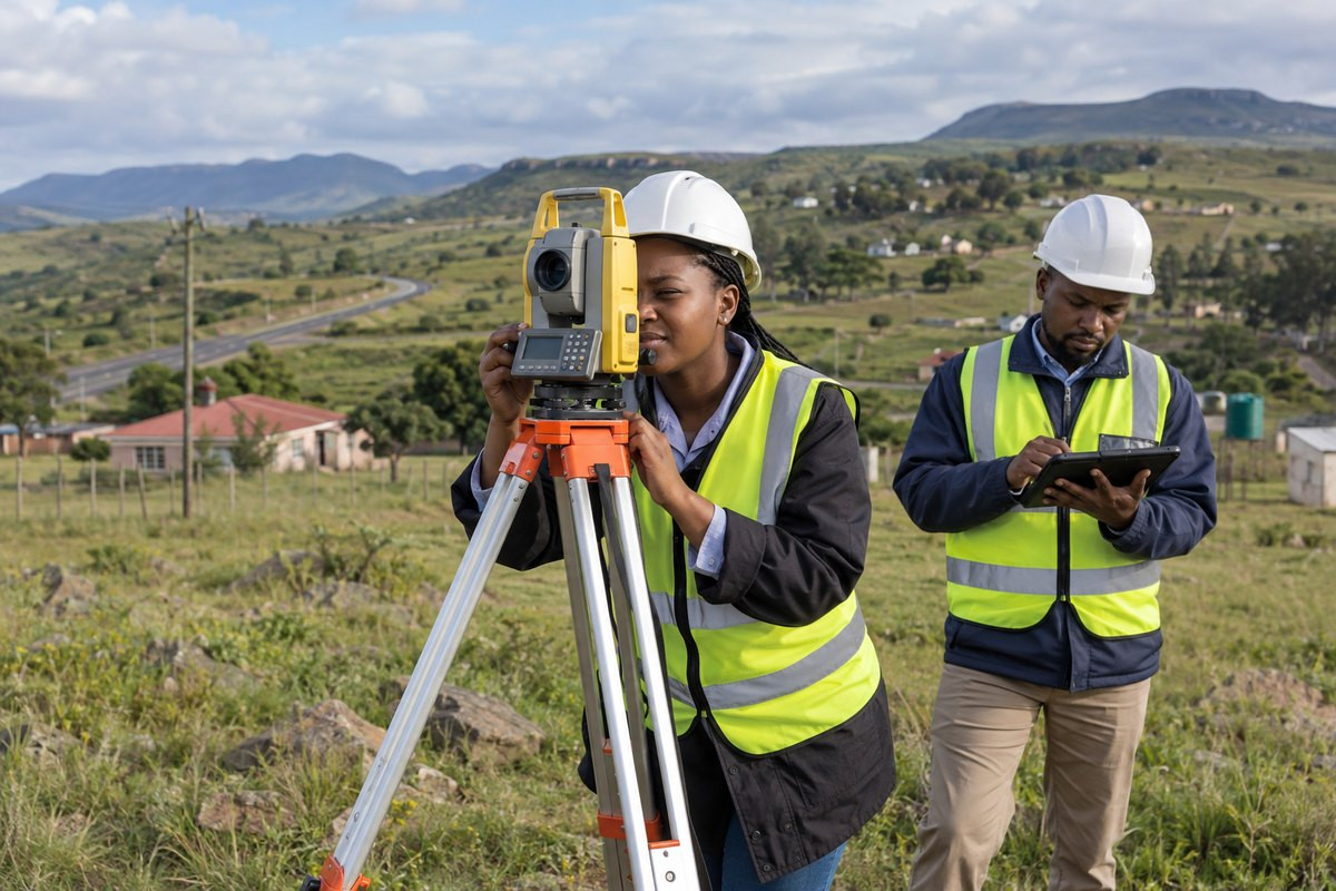
This course develops your ability to collect and interpret spatial information for surveying, mapping and land-related decisions. Learning combines technical study with practical tasks relevant to Southern African organisations and communities.

